Geo View
Info
Geo View module shows data using geographic map based on Leaflet open-source JavaScript library
Design Mode
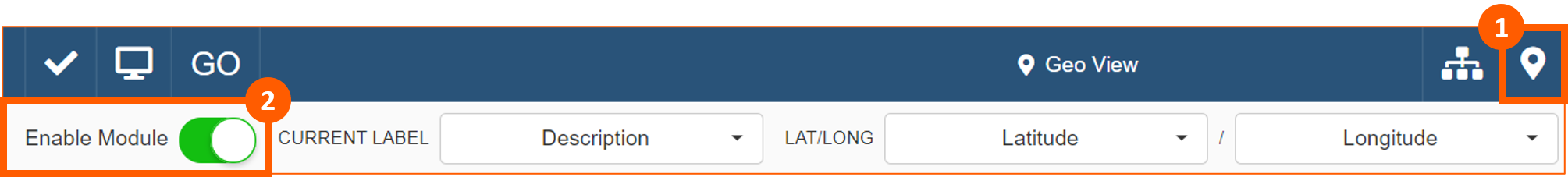
To enable the module from Design Mode, click on the Geo View icon in the Toolbar (1) and Enable Module (2):
Then chose the Current Label (1) that you want to see when the pin on the map is selected, fields useful to detect Latitude (2), Longitude (3) and to draw WKT Shape (optional) (4):

User Interface
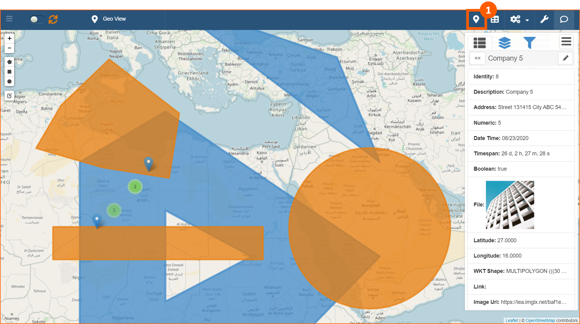
To use Geo View click on the icon (1) in the Toolbar in View Mode:
Select items
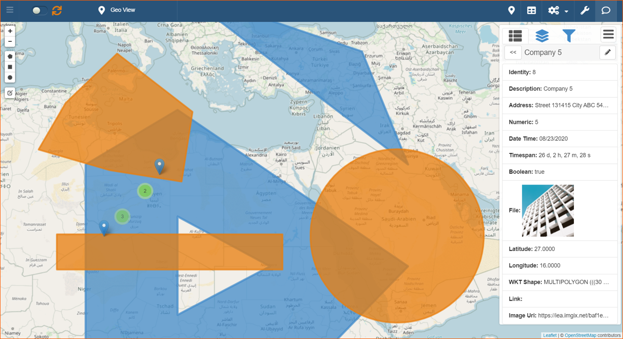
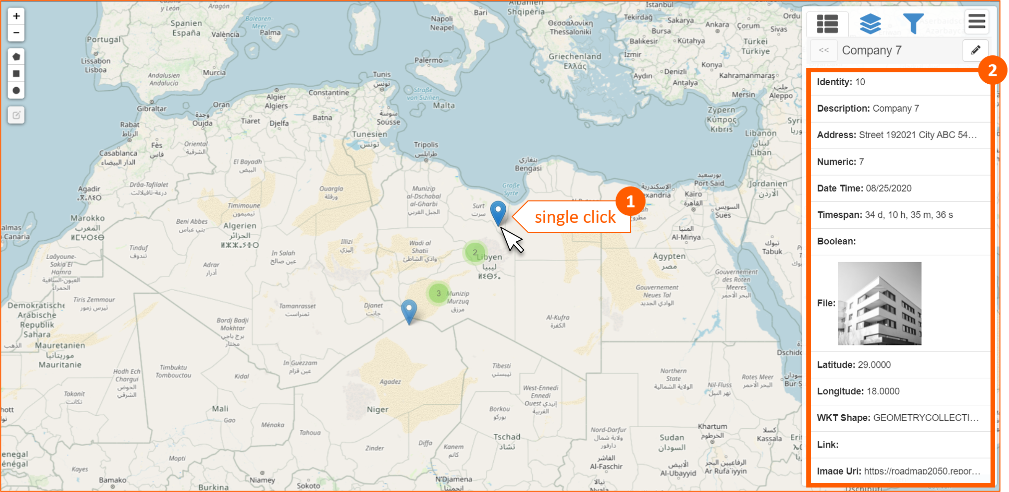
Clicking on a pushpin (1) it will be opened automatically, in the right panel, section Selected Item :fa with detailed information (2) about that item:
Cliking on a cluster (1) it will be opened automatically, in the right panel, items included in the cluster (2), with the possibility to choose one of them (3):
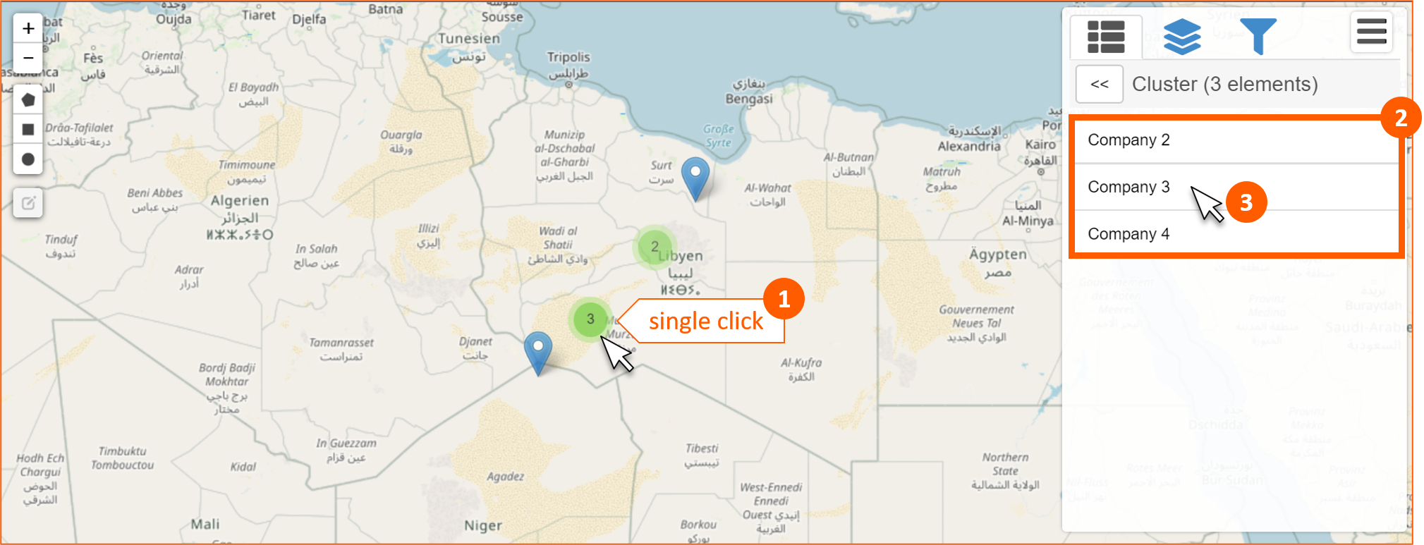
If you have selected an items, clicking on icon will be shown again the entire list of the items included in the cluster.
WKT Shape
WKT (Well Known Text) is a text markup language for representing vector geometry objects.
This is the syntax for all the shapes supported in eLegere that you have to put directly in the cell of the field:
| Shape | Syntax |
|---|---|
| LINESTRING | LINESTRING (LAT LONG, LAT_n LONG_n) |
| POLYGON | POLYGON ((LAT LONG, LAT_n LONG_n, LAT LONG)) |
| POLYGON with empty spaces | POLYGON ((LAT_1 LONG_1, LAT_n LONG_n, LAT_1 LONG_1), (LAT_2 LONG_2, LAT_n LONG_n, LAT_2 LONG_2)) |
| CIRCLE | CIRCLE (LAT LONG RADIUS) |
| MULTIPOLYGON | MULTIPOLYGON (((LAT_1 LONG_1, LAT_n LONG_n, LAT_1 LONG_1)), ((LAT_2 LONG_2, LAT_n LONG_n, LAT_2 LONG_2)), ...) |
| MULTIPOLYGON with empty spaces | MULTIPOLYGON (((LAT_1 LONG_1, LAT_n LONG_n, LAT_1 LONG_1)), ..., (LAT_2 LONG_2, LAT_n LONG_n, LAT_2 LONG_2))) |
| GEOMETRYCOLLECTION | GEOMETRYCOLLECTION (Shape_1, Shape_n) |
Following are some example of each shape:
| Shape | Example | Result |
|---|---|---|
| LINESTRING | LINESTRING (30 10, 10 30, 40 40) | 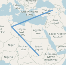 |
| POLYGON | POLYGON ((30 10, 40 40, 20 40, 10 20, 30 10)) | 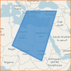 |
| POLYGON with empty spaces | POLYGON ((35 10, 45 45, 15 40, 10 20, 35 10), (20 30, 35 35, 30 20, 20 30)) | 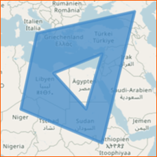 |
| CIRCLE | CIRCLE(21 23, 1000000) | 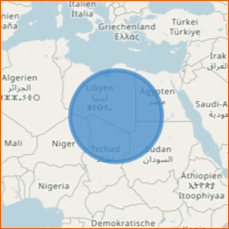 |
| MULTIPOLYGON | MULTIPOLYGON (((30 20, 45 40, 10 40, 30 20)), ((15 5, 40 10, 10 20, 5 10, 15 5))) | 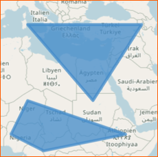 |
| MULTIPOLYGON with empty spaces | MULTIPOLYGON (((40 40, 20 45, 45 30, 40 40)), ((20 35, 10 30, 10 10, 30 5, 45 20, 20 35), (30 20, 20 15, 20 25, 30 20))) | 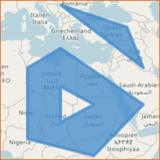 |
| GEOMETRYCOLLECTION | GEOMETRYCOLLECTION (LINESTRING (10 10, 20 20, 10 40), POLYGON ((40 40, 20 45, 45 30, 40 40))) | 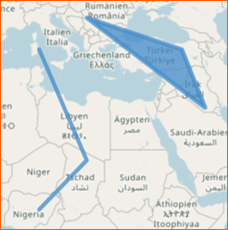 |
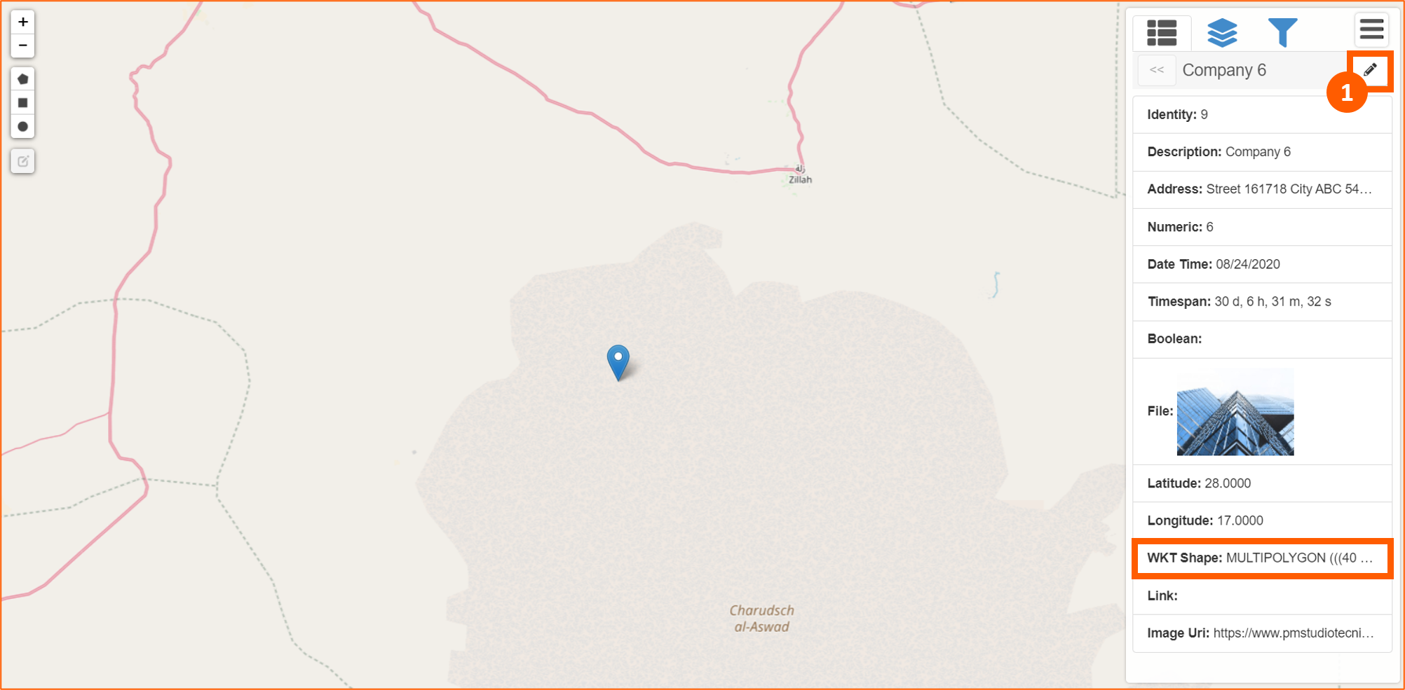
If there's a WKT Shape field setup in the App, in the Geo View right panel, there will be available a shortcut to draw it (1):
After this opertion it will be drawn the shape and automatically a new section in the right panel will be opened (1):
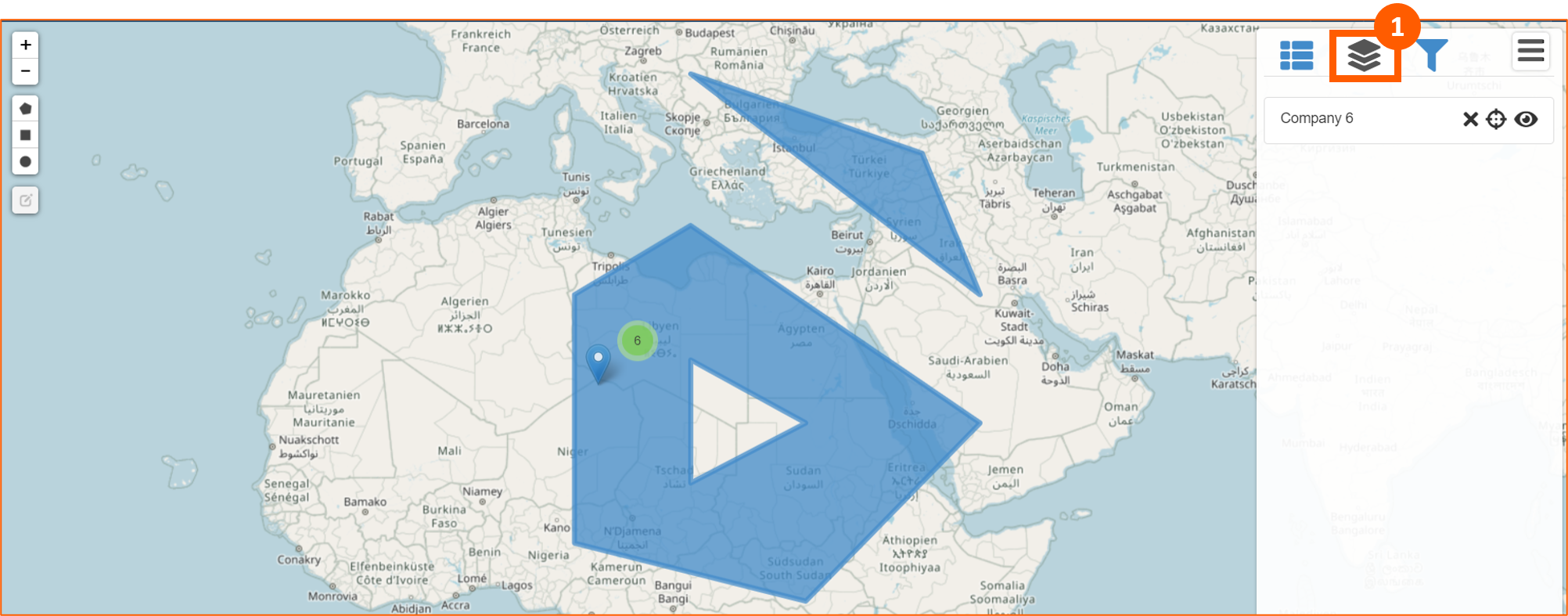
In this section there are 3 tools:
- to remove the shape
- to center the shape
- to hide/show the shape
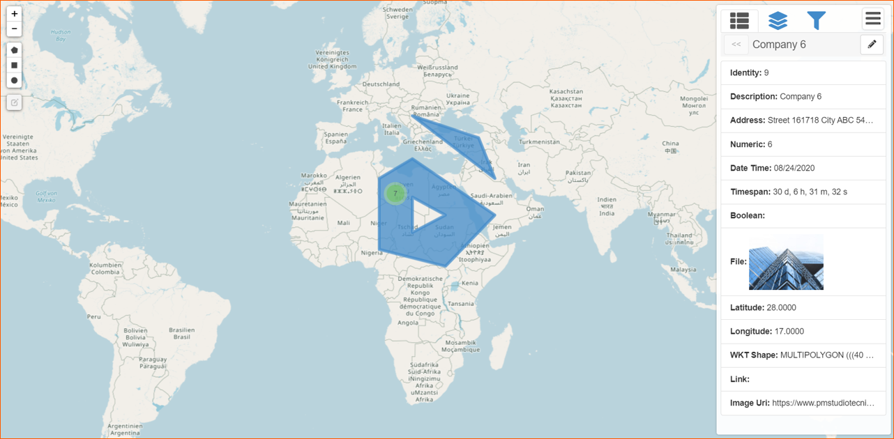
Clicking on the WKT Shape will be shown again the detailed information linked to that shape.
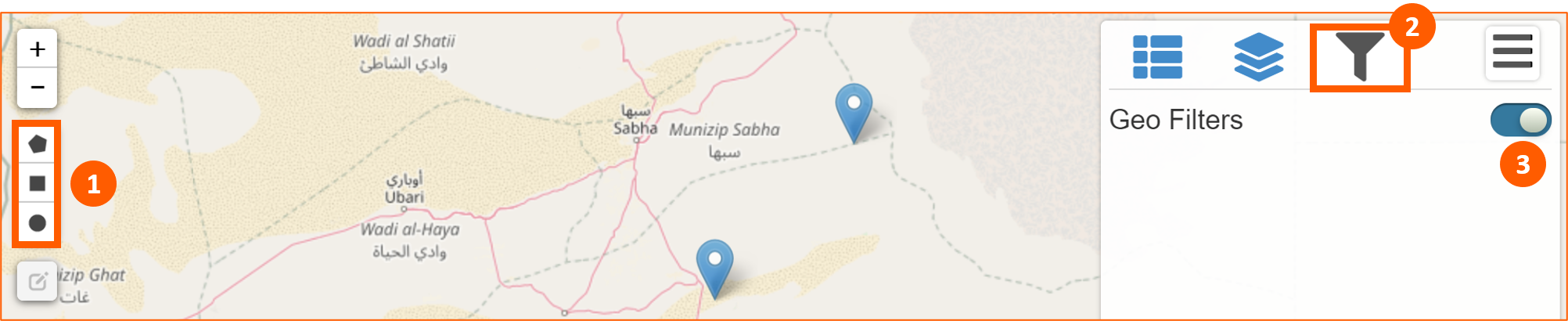
Geo Filters
You can filter data using Geo View module. Click on Geo Filters section (1), enable it (2) and draw a shape (3):
You can draw polygon, rectangle and circle on the map. After drawing it will be create a Geo Filter and it's possible to assign a label (1):
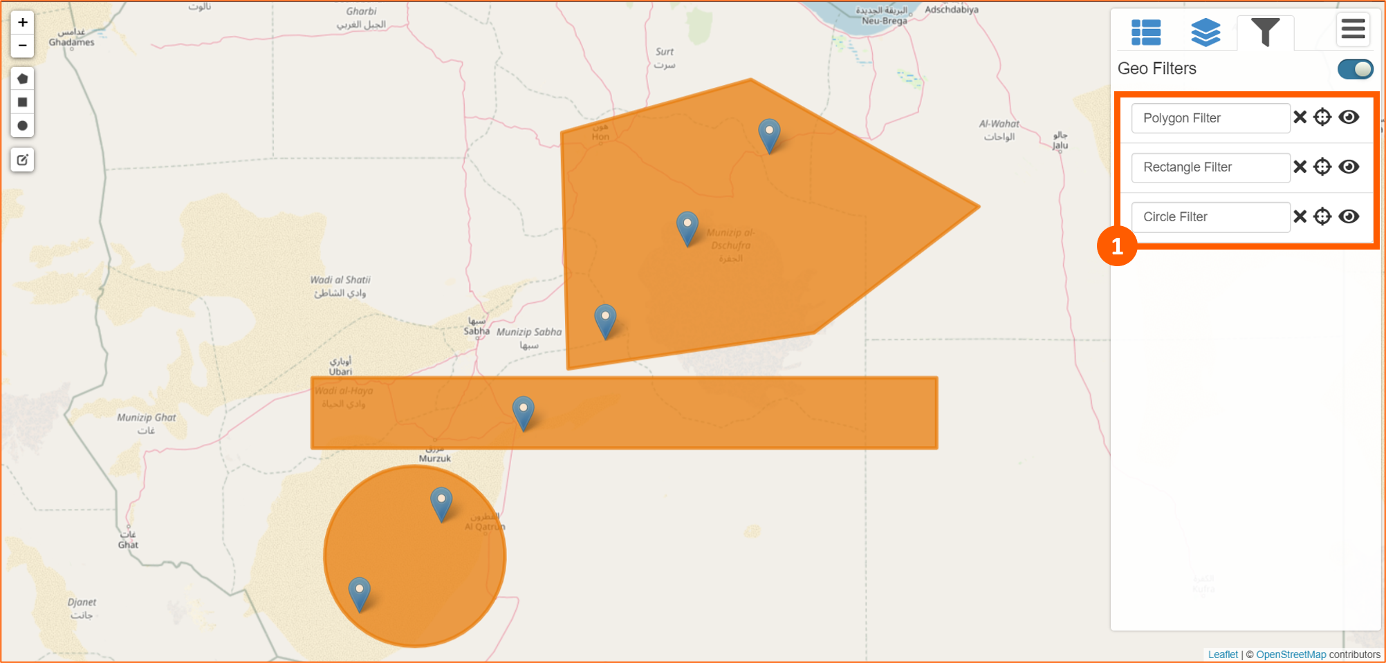
To apply these filter click on icon.
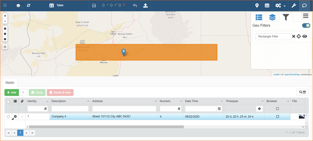
In this way, if you splitted window using icon in the Toolbar with Table for example, data will be filtered:
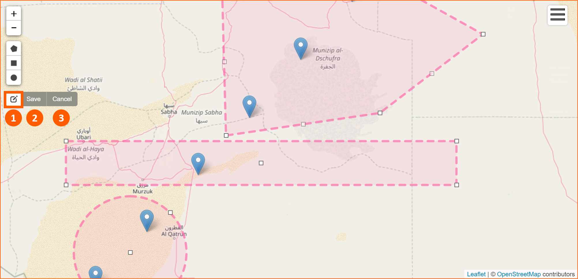
If you want to edit the filters, click on the Edit Layers icon (1). Geo Filters will change color and you can redefine the limits of every shapes. After that you can Save (2) or Cancel (3) changes: